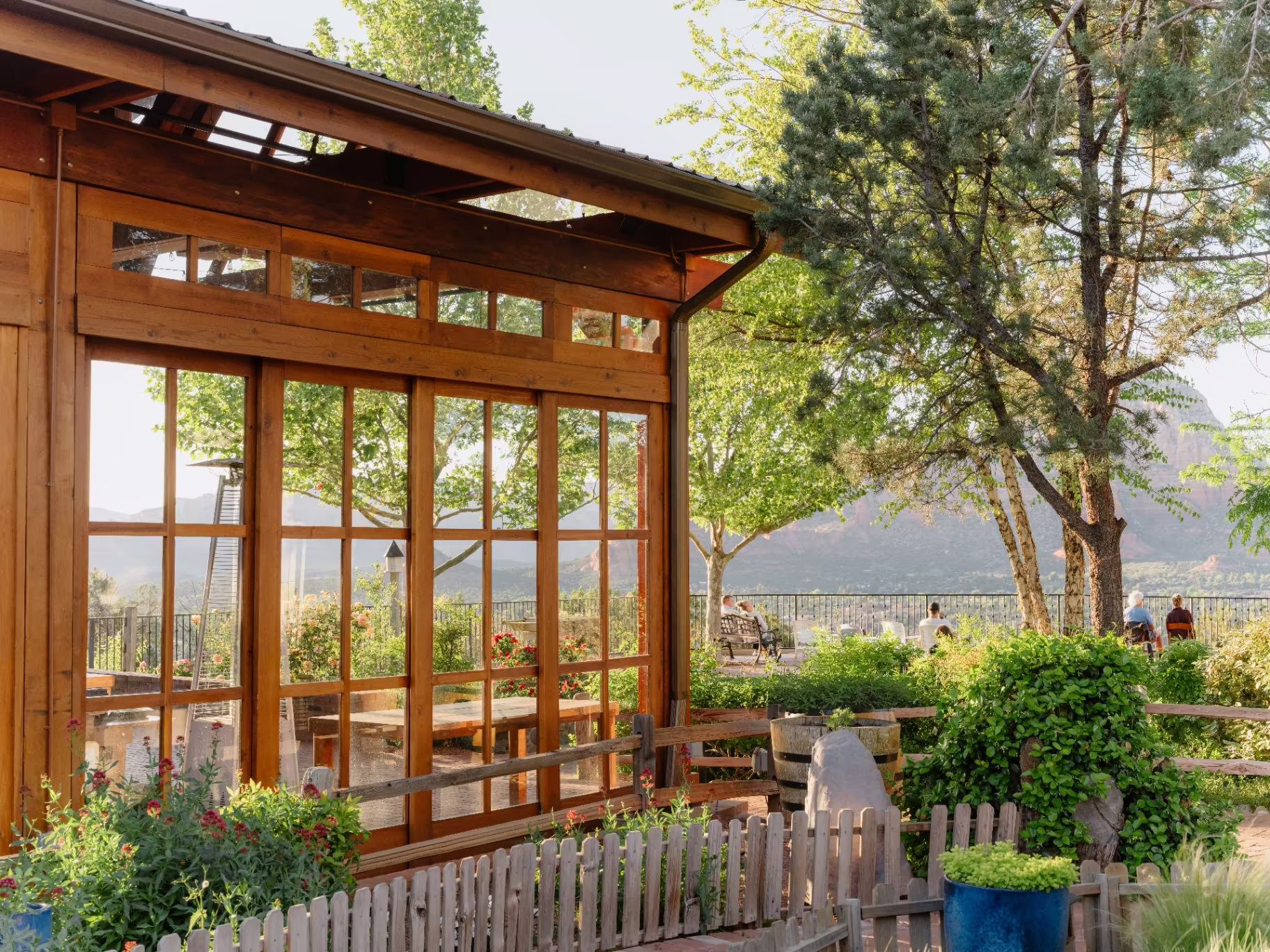
Best Rate Guaranteed
Hiker standing on Devil's Bridge sandstone arch with red rock views, Sedona

Trails & Outdoors · 9 min read

Devil's Bridge: The Complete Trail Guide

Sedona's most famous arch — how to hike it, which trailhead to choose, when to go for the photo, and where to stay nearby.

Sky Ranch Lodge
← All stories

You've almost certainly seen the photograph: a single hiker standing at the center of a slender stone span, arms raised, red rock dropping away on either side and an ocean of desert behind them. That's Devil's Bridge — the largest natural sandstone arch in the Sedona area, and the most photographed hike in a town that has no shortage of them.

The good news is that reaching it is more achievable than that vertigo-inducing photo suggests. The trail is moderate, the famous span is wider underfoot than it looks, and the whole outing fits neatly into a morning. The catch is everything around the hike: which trailhead to start from, whether your rental car can handle the road, when the light is right, and how to beat the crowds to the bridge. This guide covers all of it.

Quick facts

Devil's Bridge at a glance

Distance1.6–4.2 mi round trip (depends on trailhead)
DifficultyModerate; one short, steep rock staircase near the end
Elevation gain~400 ft
The archLargest natural sandstone arch in Sedona, ~50 ft high
From the lodgeAbout a 15-minute drive
PassRed Rock Pass or America the Beautiful required

The big decision

Choosing your route: do you need a 4×4?

This is the single decision that shapes your whole day, so it's worth understanding before you set out. Devil's Bridge can be reached three ways, and they differ mostly in how far you walk and what you drive to get there.

Starting pointRound trip4×4 needed?The trade-off
Devil's Bridge Trailhead~1.6–2 miYes — high-clearance 4×4 (or guided Jeep)Shortest hike, but you must drive the rough, rocky Dry Creek Road (FR 152)
Dry Creek Vista Trailhead~4 miNoPark at the end of the pavement and walk the jeep road in; larger lot, little shade
Mescal Trailhead~4.2 miNoReach the bridge via the Chuck Wagon Trail; more shade — the better summer choice

A few honest notes. The unpaved stretch of Dry Creek Road that leads to the closest trailhead is genuinely rough — it requires real high clearance and four-wheel drive, and it's not the place to test a standard SUV or rental car. If you don't have the right vehicle, don't force it; park at one of the paved lots and walk, or take the easy way described further down.

Between the two no-4×4 options, the distances are nearly identical. The deciding factor is usually parking (try Dry Creek Vista first, and if it's full, head to Mescal) and shade. The Mescal and Chuck Wagon route winds through more juniper and pine, which matters a great deal on a warm day — if you're hiking from mid-May through mid-September, start at Mescal.

On the trail

What the hike is actually like

From the paved lots, the first three-quarters of the walk follows an old jeep road: wide, smooth, gently rolling, lined with prickly pear, agave and juniper, with red-rock cliffs rising on every side. It's pleasant and unhurried — you'll likely be passed by the occasional Jeep tour kicking up dust.

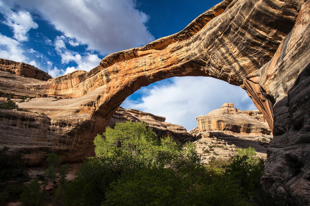
Then the trail forks. The left branch drops to the base of the arch, where you can stand directly beneath that 50-foot span and crane your neck toward the sky. The right branch is the one most people are after: it climbs a steep, natural staircase of red rock — the only demanding stretch of the whole hike — up to the bridge itself. Take your time here; the steps are tall and uneven, and a hiking pole helps on the way down.

At the top, the span is broader than the photos imply. If you have the nerve to walk out onto it, you'll find the footing reassuringly solid — but the drop is real, so use common sense, watch your step, and let the wind settle before you strike a pose.

The shot

Getting the photo

The iconic shot isn't taken on the bridge — it's taken from a rock ledge just to the side, looking across at whoever's brave enough to stand on the span. Hikers form a friendly, informal line to take turns; everyone photographs everyone, and the etiquette sorts itself out.

Two things to know about light. The arch faces east and sits in the afternoon shadow of Thunder Mountain, so timing matters more here than on most Sedona trails. The bridge is best lit a few hours after sunrise or a few hours before sunset — show up at the wrong moment and you'll find it sunk in shade. Early morning is the sweet spot: good light, thinner crowds, and a far better shot at parking.

Timing

When to go

September through June is prime time for Devil's Bridge. Summer is punishing — the Dry Creek Road route has almost no shade, and afternoon monsoon storms bring lightning — so if you visit in the warm months, take the shadier Mescal route and go at first light. In winter, the steep rock staircase (and the bridge itself) can be icy, so tread carefully after a cold snap.

Whatever the season, arrive early. On a good-weather day the parking lots fill by 7 a.m., and in peak spring and fall there can be a genuine line of hikers waiting their turn at the bridge. A sunrise start solves all of it at once; a late-afternoon start (timed to be back before dark) is the next-best option.

Logistics

Parking, passes & the shuttle

A Red Rock Pass is required to park at any of the trailheads — a few dollars a day, or a weekly pass, with America the Beautiful interagency passes accepted. Buy ahead online or at a visitor center, because the passes generally aren't sold at the Devil's Bridge trailheads themselves, and rangers do ticket. There's a pit toilet at the Dry Creek Trailhead; none on the trail or at Mescal.

On the days the free Sedona Shuttle runs — typically Thursday through Sunday, plus spring break and major holidays — it stops at the Dry Creek and Mescal trailheads, and parking at those lots may be closed to private cars. If your visit lands on those days, the shuttle from the park-and-ride is the easiest way in.

Pack list

What to bring

The desert asks for a little respect:

  • More water than you think you need — there's no water on the trail, and the air is dry year-round
  • Shoes with grip for the rock staircase
  • Sun protection — a hat, sunscreen, and a layer for cool mornings
  • An early start — the single best thing you can do for parking, crowds and heat

Hiking with your dog? Leashed dogs are welcome. Just bring water for them too, and consider whether the final rock scramble suits your companion before you commit to it.

Local shortcut

The easy way: let someone else drive

Here's the local shortcut that doubles as one of Sedona's great experiences. Because the rough final stretch of Dry Creek Road is a Jeep route, you can skip the long, dusty walk-in entirely by taking a guided 4×4 tour up to the closest trailhead — turning a four-mile round trip into a relaxed 1.6 miles, with a guide handling the bumps and the parking headaches. It's easily the most fun way to do this hike. Just ask our Experience Concierge and we'll arrange a Jeep tour that drops you near the bridge.

Sky Ranch Lodge balcony with red rock views, Airport Mesa Sedona

Where to stay near Devil's Bridge

Fifteen quiet minutes from the trailhead.

The best Devil's Bridge mornings begin with a short, quiet drive in the dark and end with coffee on a balcony as the rocks turn from rust to rose. That's the case for Sky Ranch Lodge, our family-owned boutique perched on Airport Mesa — about fifteen minutes from the Dry Creek and Mescal trailheads, set above the rhythm of town traffic, with what Forbes called the best red-rock views in Sedona.

After the trail, the rest of the day takes care of itself: a slow loop through our botanical gardens to stretch tired legs, a glass of wine on your private patio, the dog sprawled happily on the deck, our daily happy hour to trade trail stories. We're proudly pet-friendly, genuinely peaceful, and built for exactly this kind of slow-paced red-rock escape.

Have a look at our rooms and rates or browse a few seasonal offers when you're ready to plan — and let us line up the Jeep tour that makes Devil's Bridge effortless.

Trailhead FAQ

Frequently asked questions

How long is the Devil's Bridge hike?+

It depends on where you start. With a high-clearance 4×4 (or a guided Jeep) to the Devil's Bridge Trailhead, it's about 1.6–2 miles round trip. From the paved Dry Creek Vista or Mescal trailheads, it's roughly 4–4.2 miles round trip.

Do you need a 4×4 for Devil's Bridge?+

Only if you want to drive all the way to the closest trailhead — the final stretch of Dry Creek Road requires a high-clearance four-wheel-drive vehicle. Without one, simply park at a paved lot and walk in, or take a guided Jeep tour.

Is Devil's Bridge a hard hike?+

It's moderate. Most of the trail is easy walking on an old jeep road, with one short, steep section of natural rock stairs near the end. The arch itself is wider than it looks, though the drop is real.

Do you need a Red Rock Pass for Devil's Bridge?+

Yes — a Red Rock Pass or America the Beautiful pass is required to park at the trailheads. Buy one in advance, as they aren't sold at the Devil's Bridge trailheads.

What's the best time to hike Devil's Bridge?+

Early morning, September through June. An early start gives you the best light on the east-facing arch, thinner crowds, and a far better chance at parking. Avoid summer middays and afternoon monsoon storms.

Can you walk on Devil's Bridge?+

Yes. The span is solid and broader than it appears in photos, but there are steep drops on both sides, so use caution and take your time.